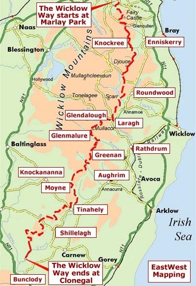
We will be walking the Wicklow Way. We will be doing it South to North. The reason for this that we get a couple days of walking before we hit the mountainous part of the hike. North to South you start in the mountains. With jet lag and all it just seem a better idea. Hopefully Peter bitches less. Navigator’s prerogative.
The Wicklow way is around 85 miles with over 10,000 vertical feet of ups and downs. I suspect when it is all said and done we will be over 100 miles. Just the way walking works out. Side trips for coffee OR a Guinness and getting to our accommodations etc etc which are not always along the trail.
Here is brief history of the Wicklow.
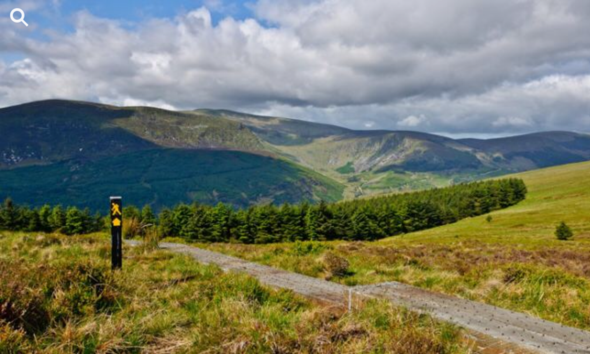
The Wicklow Way (Irish: Slí Cualann Nua, meaning “New Cuala Way“)[4] is a 131-kilometre (81-mile) long-distance trail that crosses the Wicklow Mountains in Ireland. It runs from Marlay Park in the southern suburbs of Dublin through County Wicklow and ends in the village of Clonegal in County Carlow. It is designated as a National Waymarked Trail by the Irish Sports Council and is waymarked by posts with a yellow “walking man” symbol and a directional arrow. Typically completed in 5–7 days, it is one of the busiest of Ireland’s National Waymarked Trails, with up to 24,000 people a year walking the most popular sections. The Way is also used regularly by a number of mountain running competitions.
The trail follows forest tracks, mountain paths, boreens and quiet country roads. Mountains, upland lakes and steep-sided glacial valleys make up the terrain of the initial northern sections of the Way before giving way to gentler rolling foothills in the latter southern sections. The Way also passes the Monastic City at Glendalough, founded in the 6th century by Saint Kevin.
The Wicklow Way was originally proposed by J. B. Malone in a series of newspaper articles in 1966. In 1977, Malone was appointed to the Long Distance Walking Routes Committee of Cospoir, The first section opened in 1980 and the trail was fully completed in 1982. It became the first of many National Waymarked Trails to be developed in Ireland: there are now over forty such trails, covering a distance of over 4,000 kilometres (2,500 miles). The Way forms part of European walking route E8 which stretches from the Atlantic coast of County Cork to Istanbul in Turkey. A memorial to J. B. Malone, who died in 1989, was erected on the Wicklow Way, near Lough Tay, in honour of his contribution.

I never bitch, I just make comments of the trail the navigator chooses
LikeLike
I guess i just get a bit sensitive at times.
LikeLike
“Navigator’s prerogative” – always!
LikeLike